Scientists say they now have a better idea of exactly where and when the margin of Antarctica started melting.
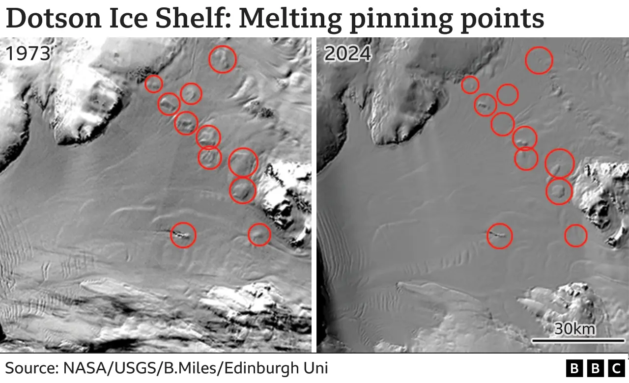
They've traced the changing shapes of bumps on the ice surface that mark locations where glaciers are anchored in place.
Half a century ago, few of these frozen moorings, or "pinning points", showed much change.
Since 2000, however, more than a third have reduced in size, emphasising the acceleration in melting.
The research is published in the journal Nature and underscores once again the increasing contribution that ice losses from the continent will make to future sea-level rise around the globe.
The study's focus was the ice shelves that fringe 75% per cent of Antarctica's coastline.
The shelves are the floating fronts of glaciers that have pushed out into the surrounding ocean.
Many of them - especially in the west of the continent - are being assaulted by warm water and are thinning as a consequence.
That's bad news because they are regarded as a key braking mechanism, slowing the movement of ice off the continent.
In places where the seafloor is shallow - where there's an underwater hill, for example - the shelves can get caught in place, holding back the glacier ice to their rear.
The pinning points are reasonably obvious to a passing satellite because they produce a lump at the shelf surface where the flowing ice has had to ride over them.
What the Edinburgh University team did was analyse through time how these bumps had changed shape.

The idea was to see if the bumps got smaller, which would imply the shelves were thinning - that they were melting; that their braking force was getting weaker.
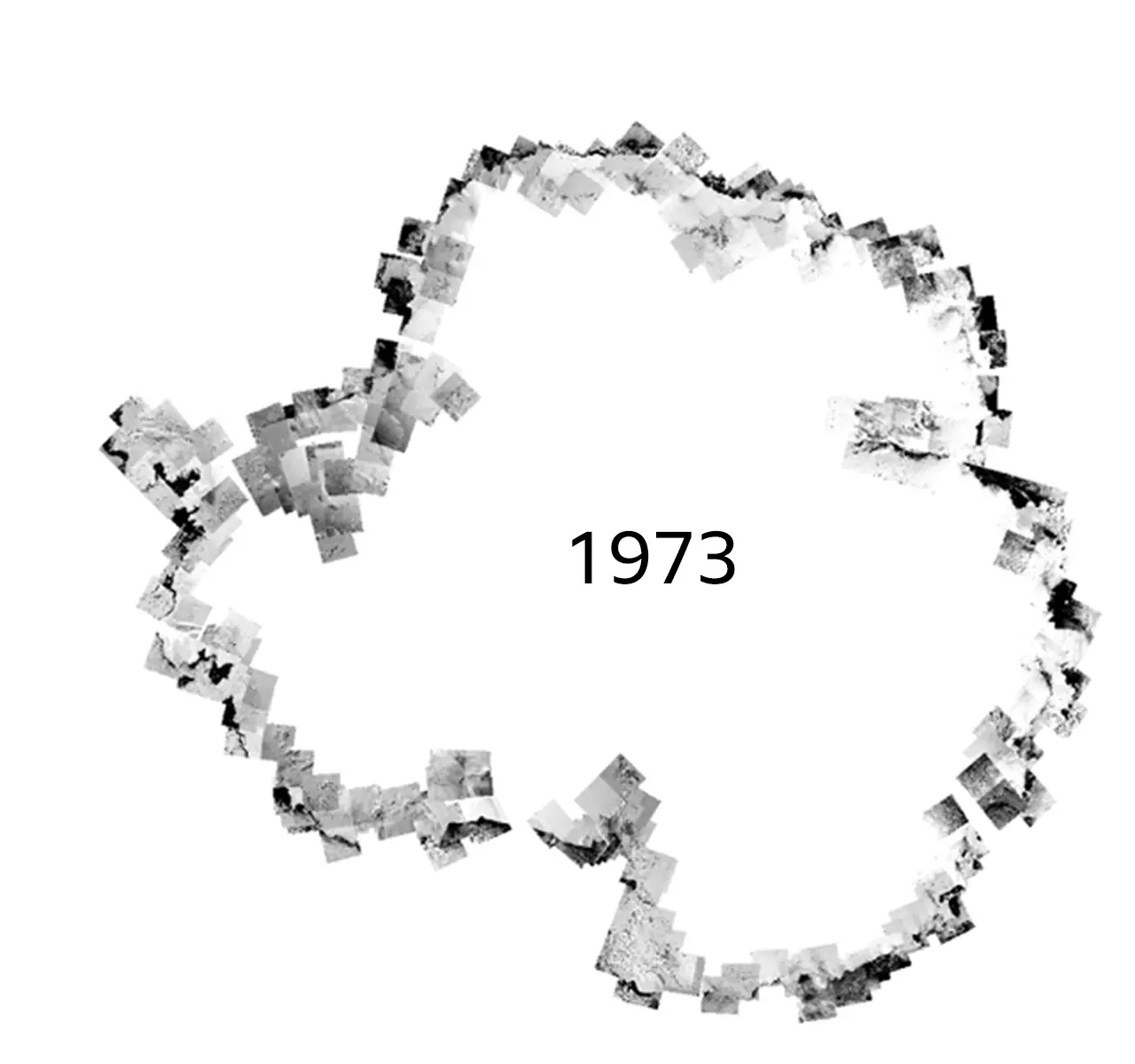
Dr Bertie Miles went back through the entire image archive from the long-running American Landsat spacecraft series to assemble new, cloudless mosaics of Antarctica's coastline.
He then analysed what happened at the ice surface during three periods: from 1973 to 1989, 1990 to 2000 and from 2000 to 2022.
In the initial period, only 15% of pinning points reduced in size. This then picked up in the 1990s, when 25% experienced shrinkage. And then, in the final period, 37% of pinning point bumps were seen to get smaller.
"As we go through the decadal snapshots, you see these bumps in general getting smaller and sometimes completely disappearing," Dr Miles said.
"The thing to remember is that once an ice shelf loses contact with a pinning point, it's very difficult to regain contact, because you get a dynamical response in the ice: it starts to speed up and the grounding line - the line where the glacier is still touching the seabed - starts to retreat," he told BBC News.
 NASA/USGS/B.Miles/Edinburgh Uni
What's interesting about this study is that it's used a different approach from how the thinning of ice shelves is normally assessed.
This is done using a specific type of satellite called an altimeter, which sends down radar pulses to very precisely measure the height of the ice surface.
But this gold standard technique only goes back 30 years to the early 90s.
By using the proxy of the ice bumps in the Landsat images, the record of thinning observations can be pushed back a further two decades.
This deeper history gave us a much better grasp of where and when ice loss really got going, said Edinburgh co-worker Prof Rob Bingham.
"The Landsat record shows you, for example, that those well known, big glaciers in West Antarctica - Pine Island and Thwaites - were quite unusual in that there was change happening on them already in the 1970s," he explained.
"But in a lot of other places, and certainly in their sector around the Amundsen Sea where the thinning is completely pervasive now - you didn't see that happening until the 1990s."
Prof Helen Fricker from the Scripps Institution of Oceanography in San Diego observes ice shelves with satellite altimeters. She commended the Edinburgh research.
"Floating shelves are to the ice sheet as flying buttresses are to buildings - they provide structural support and prop the ice sheet up.


Post a Comment